7月30日、Google DeepMindが発表した AIモデル「AlphaEarth Foundations」は、膨大な地球観測データを統合し、コンピュータが容易に処理できる統一されたデジタル表現「埋め込み(embedding)」を構築することで、地球全体の陸地と沿岸海域を正確かつ効率的に特徴づけます。科学者は地球環境の変化に関するより完全で一貫性のある全体像を把握できるようになり、食料安全保障、森林破壊、都市拡大、水資源、生物多様性といった重要な問題に関して、科学的な情報に基づいた意思決定を行うことができます。
- AlphaEarth Foundations helps map our planet in unprecedented detail(7/30 deepmind.google)
- AI-powered pixels: Introducing Google’s Satellite Embedding dataset(7/30 Google Earth and Earth Engine / Medium)
人工衛星は毎日膨大なデータを私たちに届けますが、衛星画像、レーダー、シミュレーション、レーザー測量、気候データなど形式がまちまちで、データ更新頻度も異なります。AlphaEarth Foundationsはそれらを統合し、「すべての情報を織り合わせて、地球の陸地と沿岸地域を10m四方の精細なグリッドで解析してサマリーを作成」というものです。
これらのサマリーは、「Google DeepMindがテストした他のAIシステムで生成されるデータよりも16分の1の容量で済み、地球規模の解析コストを大幅に削減する」と述べています。ブラジル全土の森林状況を監視する場合では、従来の数ペタバイトから数10テラバイトで同じ精度の分析を実現できるのです。将来的には、AlphaEarth Foundationsの埋め込みが、Geminiのような汎用推論LLMエージェントと組み合わされることで、さらに有用となる可能性があります。
AlphaEarth Foundationsによって生成された年次埋め込みのコレクションは、Google Earth Engineの「Satellite Embedding dataset」として公開されています。このデータセットは、2017年から2024年までの地球規模の年次埋め込みフィールドレイヤーを含み、オープンライセンスで利用可能です。
- Introduction to the Satellite Embedding Dataset(Google Earth Engine)
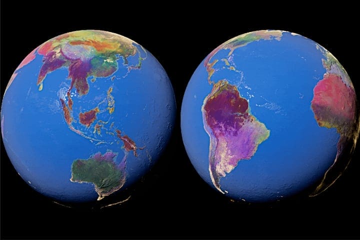
3D visualization of Earth Engine’s new Satellite Embedding dataset generated by Google DeepMind’s new AlphaEarth Foundations model. / Google Earth
Diagram showing how AlphaEarth Foundations works, taking non-uniformly sampled frames from a video sequence to index any position in time. This helps the model create a continuous view of the location, while explaining numerous measurements.